
Florence Neighbors Across Public Rolls
A block lookup works best when every source has one clear job. Boone GIS defines which parcels are actually beside an address. The PVA identifies assessed owners. Precinct maps add civic geography, while a direct association site can confirm the community's own name and public events. None of those sources is a complete list of Florence neighbors.
| Source | What It Shows About a Block | Access |
|---|---|---|
| Boone GIS parcel map | Adjacent parcel shapes, PIDNs, lots, and district context | Public map and REST identify or query tools |
| Boone GIS address points | Site numbers, street fields, sub-addresses, and parcel links | Public layer query; fields may be blank |
| Boone PVA road search | Assessed owner and parcel details along a road | Free basic search; expanded data by subscription |
| SBE-84 voter file | Permitted voter and address fields for an eligible request | Qualifying purpose, form, oath, and fee |
| Direct community sites | Community identity, events, rules, and contact route | Public pages; member areas stay restricted |
An owner name can differ from the people living at the site. Likewise, an association page does not prove membership, and an address point does not establish a household. Record the source date and describe only what the field proves.
For a small Florence block, build a row for each parcel rather than one merged roster. Note its PIDN, site address, assessed owner, map relationship, and source date. Add a community or precinct label in a separate column. This structure makes uncertainty visible and keeps one parcel's data from drifting onto the house next door.
Map a Florence Block Outward
Begin with one verified address in Boone County GIS. Click or spatially query only parcels that share an edge or sit within the chosen block. Keep parcel IDs and map relationships separate from names until each tract is checked in the PVA.
- Locate the starting address and confirm its site point and PIDN.
- Identify the parcels beside it, then record each adjacent PIDN.
- Run every PIDN through the Boone County PVA search and note the owner, situs address, and date.
- Compare any mailing address cautiously. It is an owner contact field, not proof of residence.
This narrow method answers “who is around this parcel?” without turning the task into a sweep of an entire road. For the full road-name workflow, use the Florence street directory.
Map tools can return more features than the immediate question needs. Keep the spatial search tight, and inspect one parcel at a time. If a road bends, crosses a city line, or has units stacked at one point, use the parcel outline rather than assuming that the next street number is the next neighbor.
Florence Address Points Have Limits
The Boone address-point layer exposes fields such as SITEADD1, SITEADD2, SITENUM, STRPREFIX, STRNAME, PIDN, and FEATUREID. It also has SITEOCC1 and SITEOCC2 fields. Those labels can help identify a place, unit, or secondary site description when populated.
They are not a public household roll. Blank values do not mean an empty home, and a populated label does not list everyone present. GIS services also carry planning disclaimers and selection limits. Treat the point as a link between the street address and parcel, then verify ownership in PVA.
A result may include a base address and a secondary site field. Preserve both as displayed. Do not expand an abbreviation into a person or business name without another source. For neighbors in a multi-unit setting, the building parcel and each mapped point may answer different questions.
- PIDN
- The parcel identification number used to connect map and property records.
- Situs address
- The physical location of a parcel, distinct from an owner's mailing address.
- Address point
- A mapped site or unit location, not a list of residents.
Florence Neighbor Geography Explained
The 2024 Florence Street Index uses an A through J and 1 through 10 grid. A separate city wall map shows precincts and names such as Shamrock, Devon 1, Pleasant Valley, Hopeful, and Limaburg. These are useful for placing a block, but the labels do not prove that a parcel belongs to an association.
Keep four boundaries apart: parcel lines define land, a subdivision plat defines a recorded development, a precinct serves elections, and a ZIP serves mail. City limits may cut across a postal name or road. Planning files and annexation ordinances give stronger evidence for official subdivision or city-boundary questions.
The difference matters when someone says “my neighborhood.” Everyday usage may cover a wider area than a filed plat or association. Use the person's wording as a search lead, then label the official source that supplies the boundary. A wall-map area and an HOA are not interchangeable.
Map limit. A neighborhood name on a public map is context, not proof that nearby owners joined an association.
Direct Sources for Florence Neighbors
Three direct community sites were located for Florence. Their public pages can confirm a community name, contact route, events, management, and document access. Registration or member-only areas remain a firm boundary, and no public resident roster was verified.
Hearthstone HOA
Hearthstone's direct site provides public community information and member resources. Use it for association contact, not a household list.
Tara at Plantation Pointe
Tara's association site carries announcements and a management route for the US 42 and Wetherington Boulevard context.
Saddlebrook Farms
Saddlebrook Farms publishes community history, events, and watch information without exposing a verified public member directory.
The Saddlebrook Farms site is shown below because it is the successful page capture assigned to Florence neighbors.
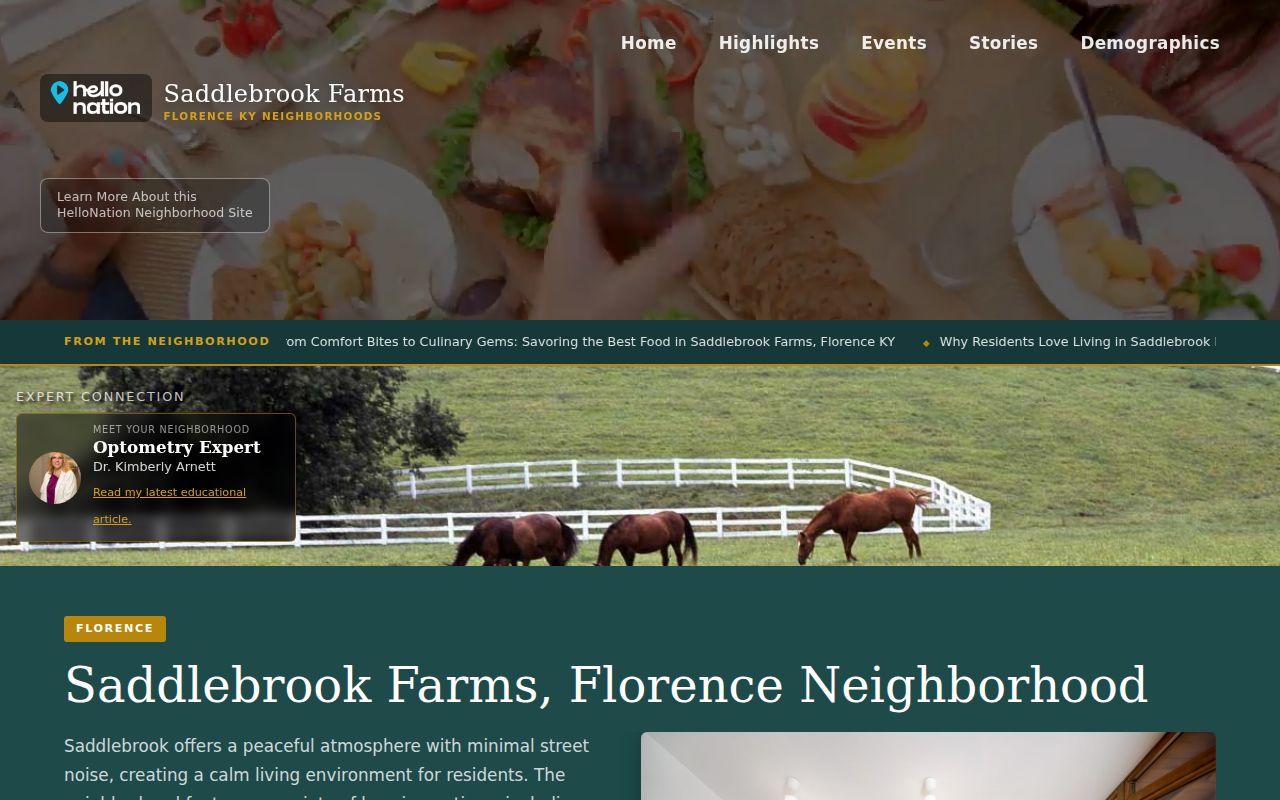
The capture confirms a direct community source. It does not turn private member data into a public record.
No authoritative umbrella directory of every Florence association was located. County plats, city planning files, and GIS remain the safer route when the direct site is silent. Public association announcements may go stale, so confirm current contacts through the organization itself.
Florence Voter Blocks Are Restricted
Kentucky's public individual voter lookup is designed for one registrant. It asks for a name, date of birth, and optionally the last four digits of the person's Social Security number. It has no control that returns all people on a Florence block.
A broader voter file uses the State Board of Elections request process and SBE-84. The requester must qualify, select an allowed scope or output, sign the oath, and pay the applicable fee. Social Security numbers are redacted under KRS 116.095, and ballot choices are not public voter fields.
Use a precinct map for area context without implying who voted or how. When the request is merely to understand adjoining parcels, GIS and PVA are the narrower, better fit.
The distinction protects both accuracy and privacy. A registrant's permitted record is not proof of current presence at the address, and an inactive status needs to be reported as shown. Never infer a full household from one voter result.
Official Florence Neighbor Records Compared
Commercial neighbor tools often merge old addresses, phone data, and unnamed third-party feeds. An official roll is narrower but gives its custodian and record purpose. That makes limits easier to state.
| Source type | Best use | Key limit |
|---|---|---|
| GIS and PVA | Map adjoining land and confirm assessed owners | Not a household list |
| Precinct and wall maps | Place the block in civic geography | No resident names |
| Direct association page | Confirm community identity and public contact | Member data may be private |
| Commercial category | Possible lead requiring official confirmation | Source date and accuracy may be unclear |
Prefer the smallest official source that answers the question. If it cannot establish occupancy, report the result as an owner, parcel, map label, or public contact rather than “who lives there.”
Planning Names Florence Communities
When an association site does not define its boundary, use plats, zoning files, GIS geometry, or an annexation exhibit. Florence boards and commissions include the Boone Planning Commission, Code Enforcement Board, and Board of Adjustment routes. These public records can identify a subdivision, parcel, case address, or municipal action.
The Weaver Road annexation covers land near Morgan Trace and Saddlebrook, while a separate record concerns land at Hopeful Church Road. Such files explain official geography. They do not prove who belongs to a neighborhood group. Request a specific map, ordinance, case, or subdivision document from the proper custodian under the Kentucky Open Records Act when it is not posted.
A useful request names the parcel, street, subdivision or ordinance, date range, and exact record sought. Kentucky agencies generally respond to a valid written open-records request within five working days or explain the delay. The law does not require an office to create a new neighbor list from separate databases.
Respect Florence Neighbor Privacy
Public property records do not reveal every occupant, and no public utility or delivery roster was found. Kentucky Safe at Home can place a substitute address in ordinary public and voter records for certified participants. Real-estate holdings are a stated exception, but that does not justify reconstructing a protected physical address from other clues.
Stop when a source is sealed, restricted, blank, or member-only. Do not guess at a household from adjacent parcels, family ties, or old directory entries. If a field appears wrong, direct the record subject to the PVA, election office, court clerk, association, or other custodian that controls it.
Lawful use. Look up Florence neighbors for civic context, reconnecting, or personal safety awareness. Never use public records to watch, harass, intimidate, or harm anyone.