
Florence ZIP Labels Explained
Official USPS material identifies two Florence labels with different purposes. ZIP code 41042 is the standard street-address label and includes postal aliases such as Devon and Hopeful Heights. ZIP code 41022 is classified for Florence post office boxes. Nearby Boone County labels belong in the comparison only when an exact address leads there; they should not be folded into Florence by assumption. Always validate the full address through USPS before using a ZIP as a geographic clue.
| ZIP Code | Areas Covered | Post Office | Notes |
|---|---|---|---|
| 41042 | Florence street-address area; Devon and Hopeful Heights aliases | Florence postal service | Standard ZIP; not a legal city polygon |
| 41022 | Florence post office boxes | Florence PO boxes | Do not map it to a physical parcel |
| 41048 | Hebron, including Francisville and Taylorsport descriptions | Hebron postal geography | Nearby Boone label, not a Florence ZIP |
| 41091 | Union | Union postal geography | Nearby label; verify any edge address |
The USPS five-digit label list supplies the current Florence lines, while the Kentucky PSC-hosted description table makes the PO BOX and STANDARD distinction clear. Neither source promises that all land carrying a Florence postal name is incorporated into the city.
Search a Florence Address
The USPS ZIP Code Lookup supports three useful paths. Address mode accepts a company, street address, optional apartment or suite, city, state, optional urbanization code, and optional ZIP. City and State mode needs those two values. Cities by ZIP accepts a five-digit code. Results may be displayed in groups of 10, 20, or 30.
| USPS field | Use | Requirement |
|---|---|---|
| Street Address | Normalize a physical delivery line | Required in address mode |
| Apt/Suite/Other | Preserve a unit detail | Optional |
| City and State | Check an accepted postal city | Required in city mode |
| ZIP Code | Find cities tied to one ZIP | Required in ZIP mode |
USPS cautions that a result does not prove that a person or company occupies the address and does not guarantee the site's actual location. It verifies the postal form of an address. Use Boone GIS or PVA for the parcel and Florence maps for the city line.
Find Florence Residents by ZIP
A ZIP code directory can narrow a search, but the official Florence sources do not expose a complete ZIP-wide resident roster. The visible PVA controls use address, parcel ID, owner, legal description, and subscription sales searches. Boone GIS contains a ZIP layer, yet a public ZIP-filter workflow was not fully observed. The individual voter portal also requires identity details rather than offering a public ZIP browse.
- Normalize the full street address with USPS and save its returned city, state, and ZIP.
- Compare the street and site address with Boone PVA and the county parcel map.
- Turn on the Boone GIS ZIP layer for context, while noting that a layer is not a household list.
- Compare the parcel with the Florence boundary and precinct map if legal city status matters.
Once the postal area narrows to a named road, the Florence street directory provides the street-level record path. Do not claim that every parcel, voter, or resident in a ZIP has been found when the source only supports one address at a time.
Keep 41022 Off Parcel Maps
The most important Florence postal quirk is simple: 41022 is described as a PO BOX ZIP. A box receives mail at a postal facility and does not provide a physical situs address. Situs means the place where the parcel is actually located. Plotting a 41022 mailing line as though it were a home would merge two different kinds of location.
If a record gives only a 41022 box, look for a physical street address in the document, parcel roll, deed legal description, or an authorized contact route. Do not infer where the box holder lives. A Florence ZIP code lookup can verify the mailing label, but it cannot supply the missing site.
Postal rule. Treat 41022 as a mailing destination, not proof of a Florence parcel, neighborhood, precinct, or residence.
Check Florence ZIP Map Layers
Boone County's parcel service exposes geographic layers that can be compared with an address point and ZIP context. The successful Boone ParcelLayers service capture documents the technical map source available for the Florence ZIP code directory.
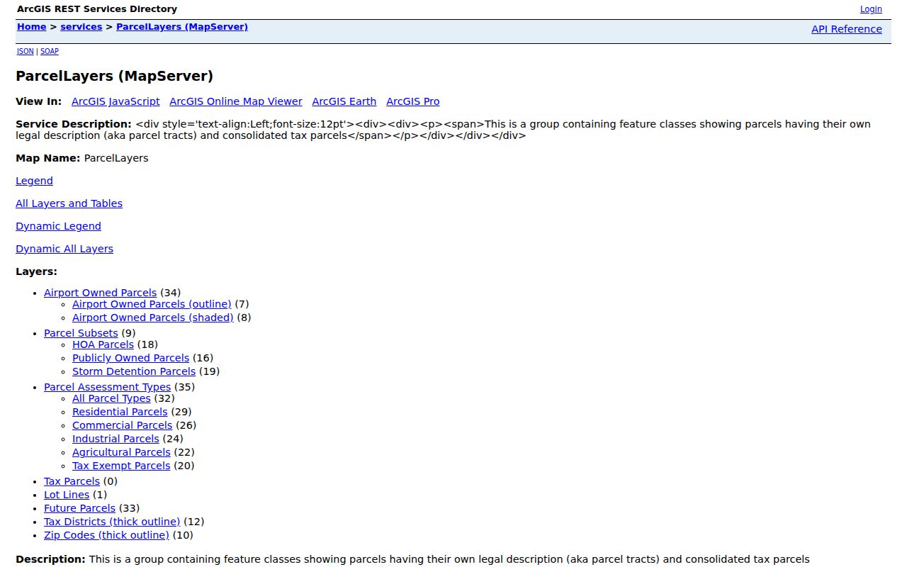
The layer helps compare shapes, but it is not an official USPS delivery-boundary guarantee. Nor does a map label establish current ownership. Pair the geometry with a PVA parcel result, and preserve the parcel ID exactly, including punctuation and leading zeros.
Note: A GIS layer may update on a different schedule from USPS labels, parcel records, precinct maps, and city annexation records.
Compare Four Florence Geographies
One Florence address can carry several valid labels at once. USPS assigns the postal city and ZIP. Boone PVA and GIS identify a parcel and physical site. Florence documents show incorporation and annexation. The Boone County Clerk's election maps place the address in a precinct. Each boundary answers a different question.
| Layer | What it answers | Best source |
|---|---|---|
| Postal | How mail is labeled and routed | USPS lookup and label files |
| Parcel | Which tract holds the site address | Boone PVA and GIS |
| Municipal | Whether land is legally in Florence | City map and annexation exhibit |
| Election | Which precinct contains the address | Boone Clerk map |
The wall map dated September 29, 2025 labels precinct areas such as Shamrock, Devon 1, Pleasant Valley, Hopeful, and Limaburg. Its scale is one inch to 1,200 feet. It offers strong visual context, but the map itself says it is for general planning and GIS use and is not a ZIP map.
Florence Counts Are Not ZIP Counts
Census QuickFacts reports 31,946 Florence residents in the 2020 census and a 2025 estimate of 34,018. Boone County reports 135,968 in 2020 and an estimated 145,316 in 2025. Those are city and county statistics, not totals for 41042 or 41022.
No official Florence per-ZIP population or voter-registration table was located in the checked city and county sources. Do not allocate city totals across postal areas or use them to guess occupants at an address. ZIP geography and Census legal geography are built for different purposes.
Trace Older Florence Postal Labels
No official Florence-specific ZIP split, merger, or boundary-realignment history was found. That gap matters. Today's 41022 and 41042 roles should not be projected backward onto an old directory entry, deed return address, obituary, or newspaper notice.
For an earlier date, consult a dated USPS label file, postal directory, local newspaper, city directory, or archive map. Record the label exactly as it appeared, then compare the legal description or street with a later parcel. Historical Florence names such as Pow-Wow, Polecat, and Crossroads show why place wording can shift while the land trail continues.
Request Florence Address Data
When the online sources disagree, ask the custodian for an existing map or dataset rather than asking an office to create a new legal ZIP boundary. USPS handles postal assignment. Boone GIS and PVA handle parcel and site mapping. Florence Public Services maintains municipal street information, while the City Clerk or county custodian can route a focused Kentucky Open Records Act request for an existing map, annexation exhibit, or address-history record.
For older labels, Boone County Public Library collections can supply directories, newspapers, and maps. State archives may hold dated government series. Include the exact address, date range, record title, and desired format in a request. That detail helps staff locate an existing record and avoids treating postal, city, and parcel boundaries as one layer.
Florence ZIP and City Limits
A 41042 result does not prove that an address lies inside Florence. The standard ZIP includes Florence postal service and aliases, while legal city status depends on the municipal boundary and annexation records. Unincorporated pockets, edge parcels, and nearby Boone labels must be resolved one address at a time through parcel geometry and city documents.
The Florence ZIP code directory therefore treats a ZIP as a search and verification clue. It never substitutes a postal name for a deed description, parcel ID, precinct, tax district, or city boundary. Where sources conflict, record each label separately and state which agency supplied it.
- ZIP vs ZIP+4
- A ZIP is the five-digit delivery area; ZIP+4 adds a more specific delivery segment.
- PO-box ZIP
- A code used for boxes at a post office rather than mapped home parcels.
- Unique ZIP
- A code assigned to one high-volume organization. None was identified for Florence in the research.
- Carrier route
- A postal delivery path that may cross other civic or statistical boundaries.